5.2. Model Applications
5.2.1. Air Quality and Composition
Data related to all areas of atmospheric composition, including ozone, smoke, dust, AOD and PM2.5
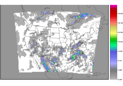
EnsembleStat: Using Python Embedding for Aerosol Optical Depth
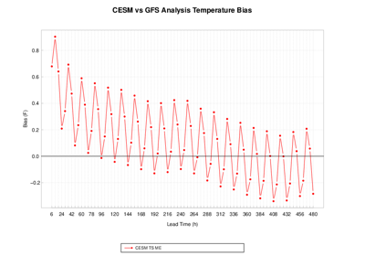
5.2.2. Climate
Average long range earth system predictions
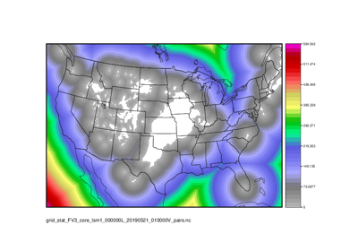
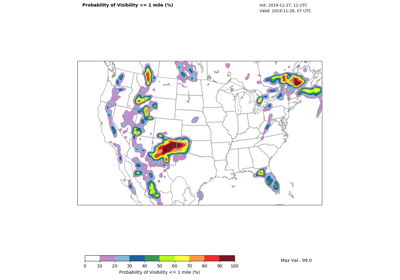
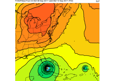
5.2.3. Convection Allowing Models
High resolution model configurations (1-4km) usually producing forecasts between 0-3 days (also referred to as limited area models, stand-alone regional, and short range weather applications)
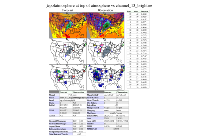
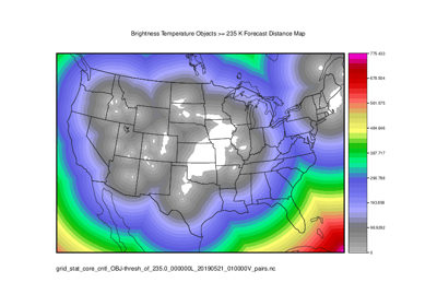
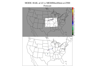
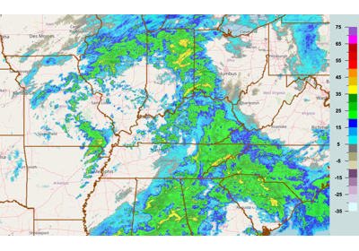
MODE/Grid-Stat: Brightness Temperature Verification and Distance Maps
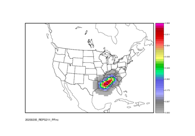
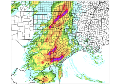
Point2Grid: Calculate Practically Perfect Probabilities
Ensemble-Stat: Ensemble Statistics using Obs Uncertainty

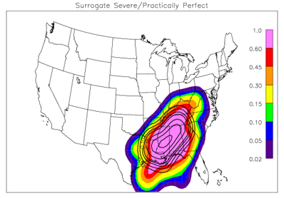
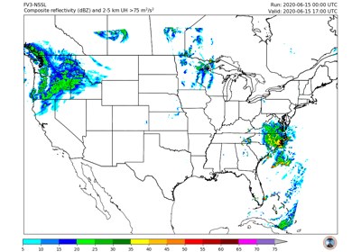
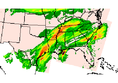
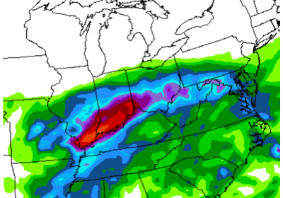
Grid-Stat: Surrogate Severe and Practically Perfect Evaluation
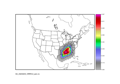
Grid-Stat: Surrogate Severe and Practically Perfect Probabilistic Evaluation
Surrogate Severe Calculation: PCPCombine, EnsembleStat, and RegridDataPlane
5.2.4. Data Assimilation
Observational data used as part of the initial conditions for numerical weather prediction
5.2.5. Marine and Cryosphere
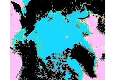
Data related to verification involving marine and cryosphere systems, which includes sea-ice
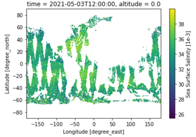
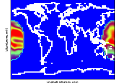
GridStat: Python Embedding for sea surface salinity using level 3, 1 day composite obs
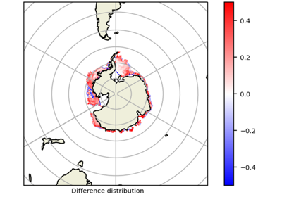
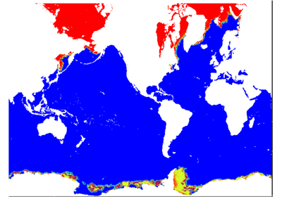
GridStat: Python Embedding to read and process ice cover
GridStat: Python Embedding for sea surface salinity using level 3, 8 day mean obs
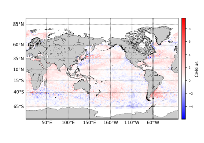
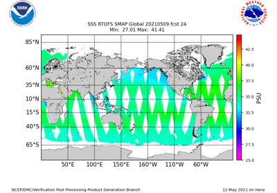
GridStat: Python Embedding to read and process SST
PlotDataPlane: Python Embedding of tripolar coordinate file
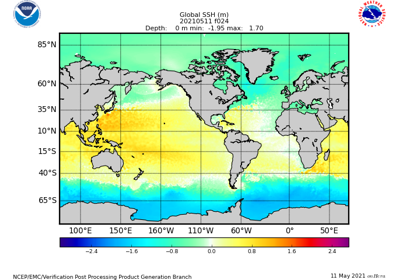
GridStat: Python Embedding to read and process sea surface heights
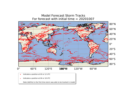
5.2.6. Medium Range
Lower resolution model configuration (>4km) usually producing forecasts out to 7-14 days (also referred to as global models)
Multi_Tool: Feature Relative by Lead using Multiple User-Defined Fields
Multi_Tool (MTD): Feature Relative by Lead (with lead groupings)
Grid-Stat: Standard Verification of Surface Fields
Point-Stat: Standard Verification for CONUS Surface

Multi_Tool: Feature Relative by Lead (with lead groupings)
Grid-Stat: Compute Anomaly Correlation using Climatology
Point-Stat: Standard Verification of Global Upper Air
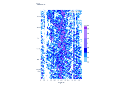
5.2.7. Precipitation
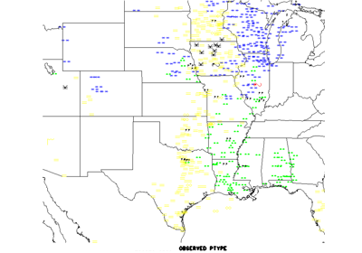
Any fields that can be defined as precipitation, including rain, snow, and other precipitation types
MTD: Build Revision Series to Evaluate Forecast Consistency

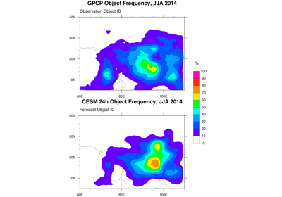
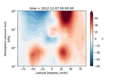
5.2.8. Subseasonal to Seasonal
Subseasonal-to-Seasonal model configurations; Lower resolution model configurations (>4km) usually producing forecasts out beyond 14 days and up 1 year
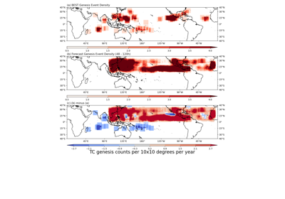
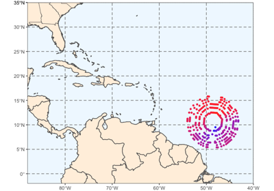
TCGen: Genesis Density Function (GDF) and Track Density Function (TDF)
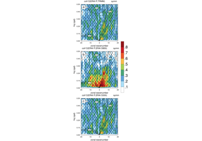
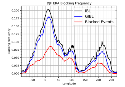
Blocking Calculation: ERA RegridDataPlane, PcpCombine, and Blocking python code
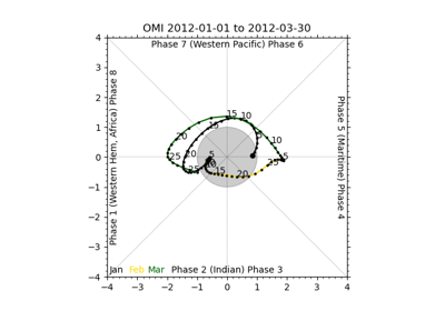
UserScript: Make OMI plot from calculated MJO indices
UserScript: Make a Phase Diagram plot from input RMM or OMI
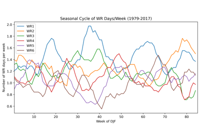
WeatherRegime Calculation: ERA RegridDataPlane, PcpCombine, and WeatherRegime python code
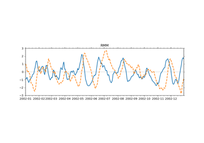
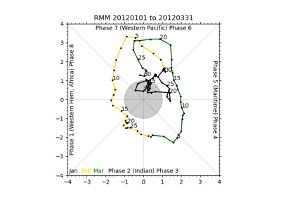
UserScript: Make RMM plots from calculated MJO indices
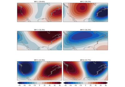
WeatherRegime Calculation: GFS and ERA RegridDataPlane, PcpCombine, and WeatherRegime python code
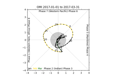
UserScript: Make OMI plot from calculated MJO indices
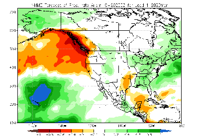
Grid-Stat and Series-Analysis: BMKG APIK Seasonal Forecast
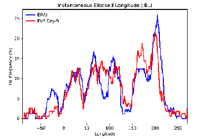
Blocking Calculation: GFS and ERA RegridDataPlane, PcpCombine, and Blocking python code
5.2.9. Space Weather
Upper atmosphere and geospace model configurations

5.2.10. Tropical Cyclone and Extra Tropical Cyclone
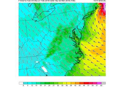
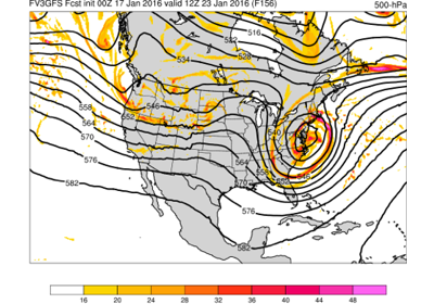
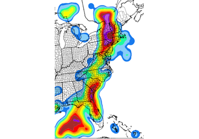
Any field that is associated with Tropical Cyclone and Extra-tropical Cyclones
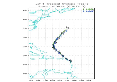
Track and Intensity Plotter: Generate mean, median and box plots
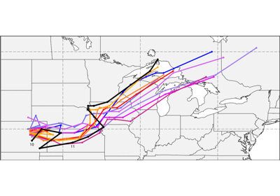
CyclonePlotter: Extra-TC Tracker and Plotting Capabilities
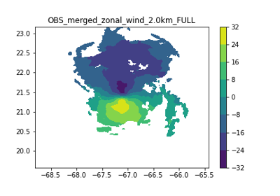
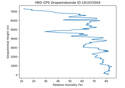
Grid-Stat: Verification of TC forecasts against merged TDR data
Point-Stat: Standard Verification for CONUS Surface

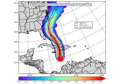
TCGen: 2021 Global Forecast System (GFS) Tropical Cyclone Genesis Forecast

CycloneVerification: TC Verification Compare ADECK vs BDECK