2.4. GOES ABI L2 Aerosol
- Description
Geostationary Operational Environmental Satellite (GOES-16/17) Advanced Baseline Imagers (ABIs) Data - Level 2 Aerosol Products
- Sample image
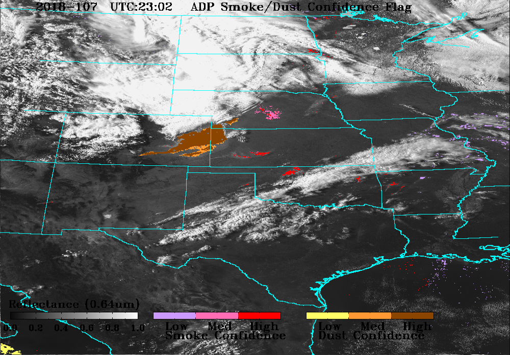
Image frm NOAA/SSD
- Recommended use
Evaluating air quality, visibility, and dust with remotely-sensed data
- File format
NetCDF
- Location of data
GOES-16: https://console.cloud.google.com/storage/browser/gcp-public-data-goes-16
GOES-17: https://console.cloud.google.com/storage/browser/gcp-public-data-goes-17
Note: There are other government institutions, cloud providers, and research institutions that provide this data.
- Access restrictions
None (when using Google Cloud)
- Spatial resolution, grid, or coverage
Full disk, CONUS/PACUS, and mesoscale domains
The GOES-16 is centered equatorially at 75.2 W. GOES-17 is centered at 137.2 W.
The IR channels of ABI have 2-km spatial resolution at nadir.
- Temporal resolution
Full disk: 5-15 min
CONUS: 5 min
Mesoscale: 30-60 s
- Starting and/or ending dates
2017-Present for aerosol optical depth (on Google Cloud)
2019-Present for aerosol detection (on Google Cloud)
- Data latency
~10 min
- Variables available
ABI L2 aerosol detection (ADP)
ABI L2 aerosol optical depth (AOD)
- METplus Use Cases
Link to METplus Use Cases for this dataset.
- Keywords
Note
Current Dataset: VxDataGOESLEV2AERO
Note
Data Labels: DataTypeGridded, DataLevelSatellite, DataProviderNASA, DataApplicationConvectionAllowingModels