2.15. VIIRS
- Description
Visible Infrared Imaging Radiometer Suite (VIIRS) This instrument is on a polar-orbiting satellite providing global observations related to the atmosphere, oceans, and Earth’s surface. This information is focused on aerosol optical thickness (other VIIRS products are available).
Sample image
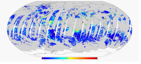
Image from NOAA/STAR
- Recommended use
Evaluating aerosol properties with remotely-sensed data
- File format
NetCDF
- Location of data
VIIRS Atmosphere: https://earthdata.nasa.gov/earth-observation-data/near-real-time/download-nrt-data/viirs-a-nrt
VIIRS Land: https://earthdata.nasa.gov/earth-observation-data/near-real-time/download-nrt-data/viirs-nrt
- Access restrictions
Requires a free Earthdata account
- Spatial resolution, grid, or coverage
Global coverage via polar orbiting swaths, with approximately 1 pass per day per given location near the equator
At-nadir resolution of 6 km x 6 km
- Temporal resolution
6 min
- Starting and/or ending dates
For Level 2 Dust AOD: 1 March 2012-Present
- Data latency
147 min
- Variables available
Aerosol optical thickness at 550 nm over land, ocean, and land/ocean
- METplus Use Cases
Link to METplus Use Cases for this dataset.
- Keywords
Note
Current Dataset: VxDataVIIRS
Note
Data Labels: DataTypeGridded, DataLevelSatellite, DataProviderNASA, DataApplicationConvectionAllowingModels, DataApplicationMediumRange