2.16. IMS
Description IMS stands for the Interactive Multisensor Snow and Ice Mapping System.
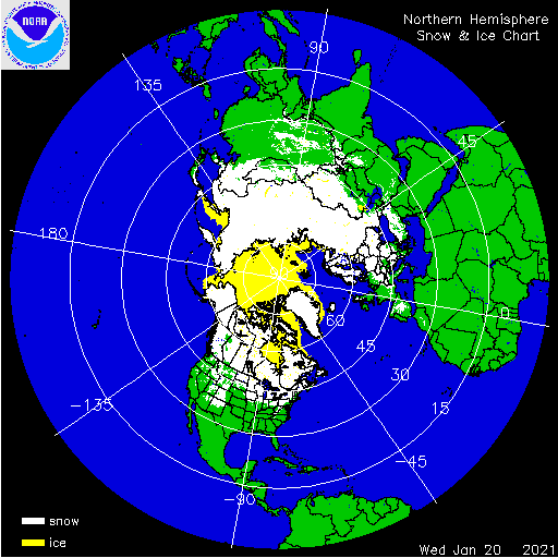
“This data set provides maps of snow cover and sea ice for the Northern Hemisphere from February 1997 to the present from the United States National Ice Center (USNIC).” from the National Snow and Ice Data Center (NSIDC)
Sample image
- Recommended use
“The IMS product is considered an operational product” from NSIDC
“Accurate monitoring of global snow and ice cover is a key component in the study of climate and global change as well as daily weather forecasting.” from NSIDC
This is used as observation data in both research and operations.
- File format
ASCII Text (gridded data)
GeoTIFF (Geographic metadata)
GIF (images)
- Location of data
NSIDC: https://nsidc.org/data/G02156/versions/1 Click on the “Download the Data” tab.
- Access restrictions
None
- Spatial resolution, grid, or coverage
Northern Hemisphere only (N: 90, S: 0, E: 180, W: -180)
There are three resolution options: 1 x 1km, 4 x 4km, 24 x 24km
- Temporal resolution
1 Day
- Starting and/or ending dates
February 1997 - Present
- Data latency
1 Day
- Variables available
Snow and Ice Analysis: * 1 (sea) * 2 (land) * 3 (sea ice) * 4 (snow) * 0 (outside Northern Hemisphere).
- METplus Use Cases
Link to METplus Use Cases for this dataset.
- Keywords
Note
Current Dataset: VxDataIMS
Note
Data Labels: DataTypeGridded, DataLevelSurface, DataProviderNSIDC, DataApplicationMarineAndCryo